UK Issued Two Different Coordinates for Gulf Incident
Friend | 04.04.2007 08:21 | Analysis | Anti-militarism | Terror War


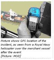
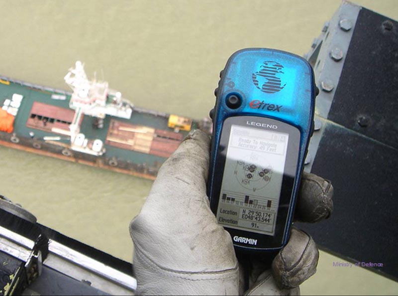
Unfortunately for the MOD, it appears that they have used two different sets of position coordinates to fix the site of the incident. One of these coordinates is quoted in the text [1] (para 4), another is pictured in their photograph [2] taken from a helicoptor. Furthermore, the data was presented in the same press briefing. Assuming that both sets of data were expressed using the same coordinate system this is, at the least, an embarrassing over sight.
"As shown on the chart, the merchant vessel was 7.5 nautical miles south east of the Al Faw Peninsula and clearly in Iraqi territorial waters. Her master has confirmed that his vessel was anchored within Iraqi waters at the time of the arrest. The position was 29 degrees 50.36 minutes North 048 degrees 43.08 minutes East. This places her 1.7 nautical miles inside Iraqi territorial waters. This fact has been confirmed by the Iraqi Foreign Ministry."
We have submitted the following Freedom of Information request to the MOD to try and clarify what was going on:
I am writing regarding the press release "MOD briefing shows Royal Navy personnel were in Iraqi waters" March 28th 2007, published online at
 http://www.mod.uk/...
 It can be observed that the coordinates on the Garmin GPS handset photo on the MOD site are different from the coordinates quoted in the text of the same press release (N 29 50.174 vs. N 2950.36 and E 48 43.544 vs. E 48 43.08).
It therefore appears, that according to the GPS data, the ship was actually 0.5 nautical miles further east (towards Iran) than stated and 0.2 nautical miles further south.
My questions for the FOI request are:
(1) which of the 2 coordinate data published by the MOD should be taken as indicating the position of the incident?
(2) are both sets of coordinate data expressed in the same geographic coordinate system and what is the system used?
With thanks
References:
[1]
 http://www.mod.uk/DefenceInternet/DefenceNews/MilitaryOperations/ModBriefingShowsRoyalNavyPersonnelWereInIraqiWaters.htm
 [2]
 http://www.mod.uk/NR/rdonlyres/DB42AC92-E1CC-4478-9910-B8CB299A6612/0/HeloGPS.jpg
 Related:
 http://mparent7777-2.blogspot.com/2007/04/iran-german-armed-forces-university.html
 German Armed Forces University: British Boundary Map "Fictitious"
the two pictures below show GPS location of the incident, as seen from a Royal Navy helicopter over the merchant vessel after the event [Picture: MOD]
Friend
 Homepage:
http://www.wakeupfromyourslumber.com/node/1114
Comments
Display the following 6 comments