Pictures of the "security fence/wall"
fwd | 04.08.2003 21:26 | Repression | World
Here are some pictures of the wall build in the West Bank
and originally published on Germany Indymedia by Imc Munich with a German audio interview.
 http://germany.indymedia.org/2003/08/58698.shtml
and originally published on Germany Indymedia by Imc Munich with a German audio interview.
http://germany.indymedia.org/2003/08/58698.shtml
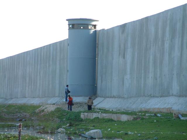
the wall
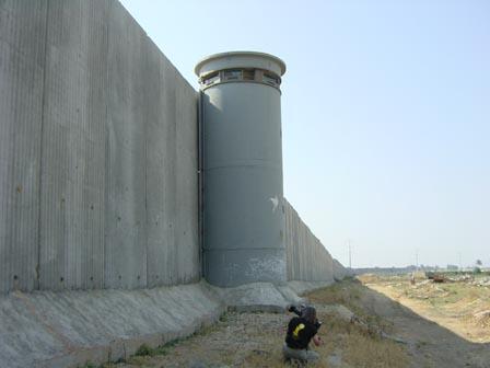
the wall
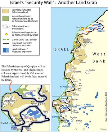
Map
"they have also been in a peace camp, near Mas'ha, a Palestinian village, which is run and visited by Israeli, Palestinian and International peace activists. This camp is on the ground of the farmer Nazheen Shalabi, who is helping out in the camp. Shalabis house is situated on the Arabic, his olive trees will be in future on the Israeli side and by the building of the wall it won't be accessible nor usable for him. The camp wants to draw attention of this way the systematic land dispossession by the building of the wall, which is three times higher and longer then the Berlin wall and is said to protect the israeli side of the Palestinian..
Often even for many Israeli unknown, is, that the wall, which actually far from the roads is a several hundred kilometers big fence, is pushing deeply into the autonomous areas of the west bank and takes valuable land and water resources for the Israeli side and far away from the factual border.
Many Palestinian villages on the "Israeli" side of the wall are therefore getting forcefully isolated as well."
fwd
Comments
Display the following comment